

Manage and control the flow of data between files, databases, and servers
SIS ETL (Extract, Transform, Load) provides tools to manage and control the flow of data (files, PostGIS or SQL Server databases and SWDs) through servers.

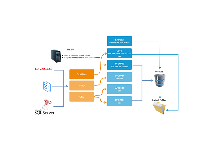
Create a workflow that streamlines spatial data management and provides concurrent data for a cloud or remote data service
SIS ETL supports the following operations and formats:
- COPY – Moves updated files (BDS, FDB, ODB, SHP, and TAB) from and to defined locations
- UPLOAD – Pushes data from FDB, SHP, TAB or SWD project files into a PostGIS or SQL Server database, replacing any existing tables. When using the project file option, all supported SIS vector formats can be included
- APPEND – Allows CSV data to be added to an existing table
- UPDATE – Drops an existing database table and populates a new one with the CSV
This streamlining process helps provide concurrent data for a cloud or remote data service.
SIS ETL can also regularly export data from the spatial database (PostGIS or SQL Server) to GIS files. This is useful when the database tables have been updated and are required by other systems.
Book a demo
Discover how NEC Geospatial Solutions can help your organisation connect data, improve decision-making and deliver better outcomes for communities.